Cycling the Wray Valley Trail + Teign River (Video and Route)
Cycling the Wray Valley Trail has been on my to-do list for approximately two weeks - yup. I was researching the Dartmoor Way and came across this neat little trail.
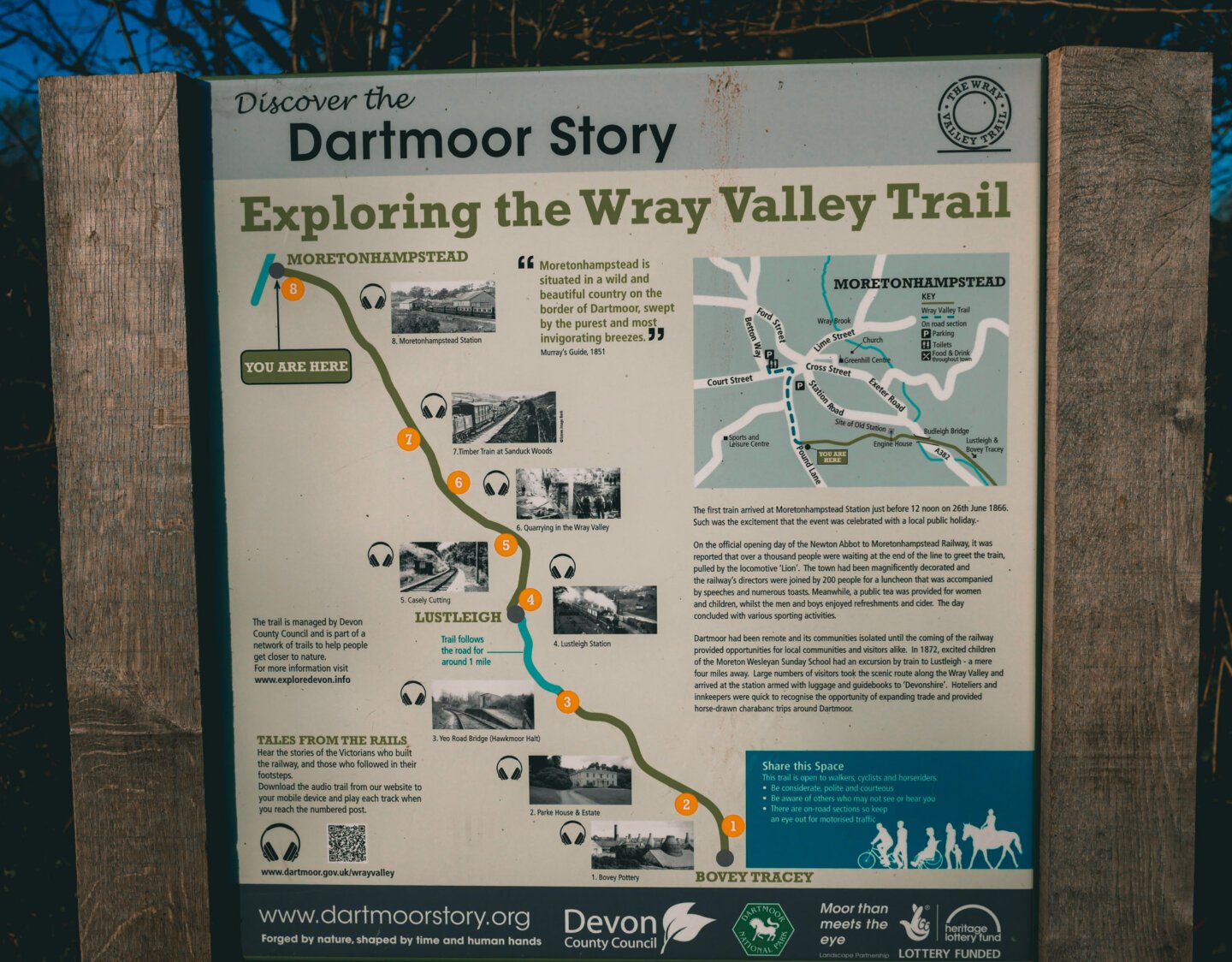
Stretching from Bovey Tracey right on the south eastern edge of the national park, around 7 miles up to Moretonhampstead, the Wray Valley Trail mostly uses a disused railway line.
Having spent all of Lockdown #2 riding exclusively from my front door, I decided to treat myself to a full 25 minute drive to Somewhere Different. I know, exciting right?!
You betcha, because this route is super lush.
Cycling the Wray Valley Trail (with extra hills)
After two pretty damn hilly 30 mile rides over the last two weekends, I thought I'd treat us to a flat-ish ride. Except, the Wray Valley Trail is only a 14-mile round trip (and not actually flat), so I decided to add on an extra 8 miles, taking us to the Teign River below Castle Drogo, along to Fingle Bridge, and back to the Wray Valley Trail.
Yes...I added in a couple thou feet of ascent. Whatever. I'm very optimistic when I'm plotting routes from my exceptionally comfortable second-hand-bargain sofa.
As you can see on the elevation chart above, there's a gentle incline south to north although it's not particularly noticeable. It is, however, noticeable on the way back when the slight declination allows you to absolutely zoom along. I've never ridden one, but I imagine it's how riding an e-bike feels all the time.
Step One: Get to Bovey Tracey
Despite it's slightly weird name (a conglomeration of the River Bovey and the historic family 'de Tracey', if you're interested), this town is fairly small and rather lovely. It's filled with cafes and parks and bridges and...well...cyclists. It also has plenty of parking and a set of public toilets which is always useful for the cyclist who's drunk too much coffee pre-ride. Ahem.
The Wray Valley Trail starts in the centre of the town and runs through the National Trust's Parke estate, which is also home to the Dartmoor National Park HQ. This section is busy as it's not only perfect and beautiful for cycling, but for walking your dog, pushing your infants, teaching offspring to ride a bike, loitering as a teenager and walking five abreast, very slowly. Like I say, it's a nice place, everyone wants in.
It doesn't take too long for the crowds to fall away and the railway line opens up in all its glory. As I've just ridden it at the end of November, the trees are almost entirely bare and the path is entirely golden.
Step Two: Get to Moretonhampstead
The Wray Valley Trail is an easy ride, regardless of your ability. It has a couple of short and steep-ish hills in the middle, where there's a short road section to Lustleigh. This can complicate the trail if you've got children with you, but the road is a quiet one so it's not unsafe.
After that, you pick up the trail again and ride it all the way to Moretonhampstead which does involve a steep but quiet hill to get up to the high street. This is, presumably, where many people stop for a slice of cake before turning around and practically freewheeling back to Bovey.
While the trail is glorious, if you're after a longer ride and are game for some real hills, the best is yet to come.
Step Three: Admire all the views
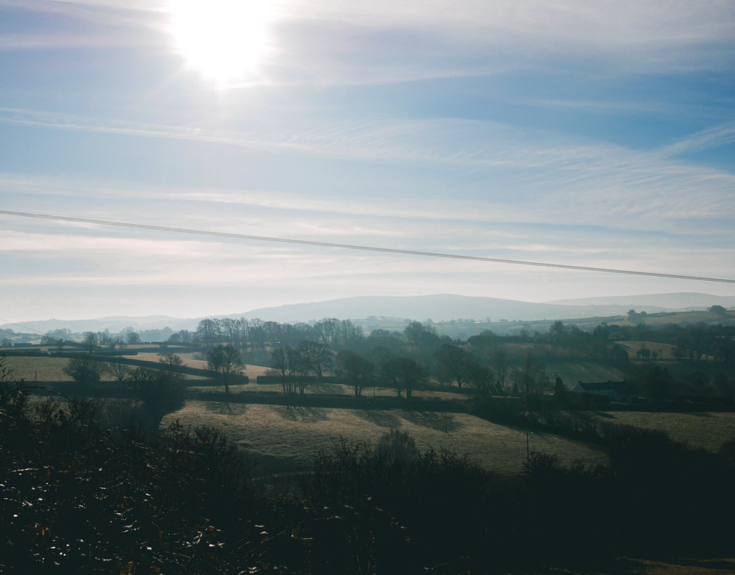
Cycling out of Moretonhampstead quickly takes you onto back lanes that seldom see cars, if the amount of mud is anything to go by. We rode all the way to Forder where the bridleway starts and only saw one car.
This lane offers outstanding views over the Wray Valley with its endless farmland and sedate sheep community. While it's a single lane route with passing places, it's so quiet that you can stop regularly to admire the sights.
The lane ends with an awesome, steep descent that would be much faster in summer when the risk of slipping is gone but it still fun in autumn when you're taking your life in your hands if you let go of the brakes.
Don't overshoot and cross the bridge, the permissive bridleway is slightly hidden on the right hand side.
Looking for more Devon bike rides? Check out my cycling files!
Step Four: Fall in love with the Teign
The Teign River is a smug bastard. It chortles through exquisitely beautiful woodland for miles and is so picturesque you might spend more time photographing it than actually riding along it.
The bridleway takes you along the river all the way to Fingle Bridge (you can ride it considerably further, to Dunsford, which is just as marvellous). The bridleway here, in November, is blanketed in leaves, mud and rocks. It's undulating too, adding an extra whiff of challenge.
When I was there, it was also hoarding a freezing mist, giving the woodland a sort of eerie, ghost-story-esque feel.

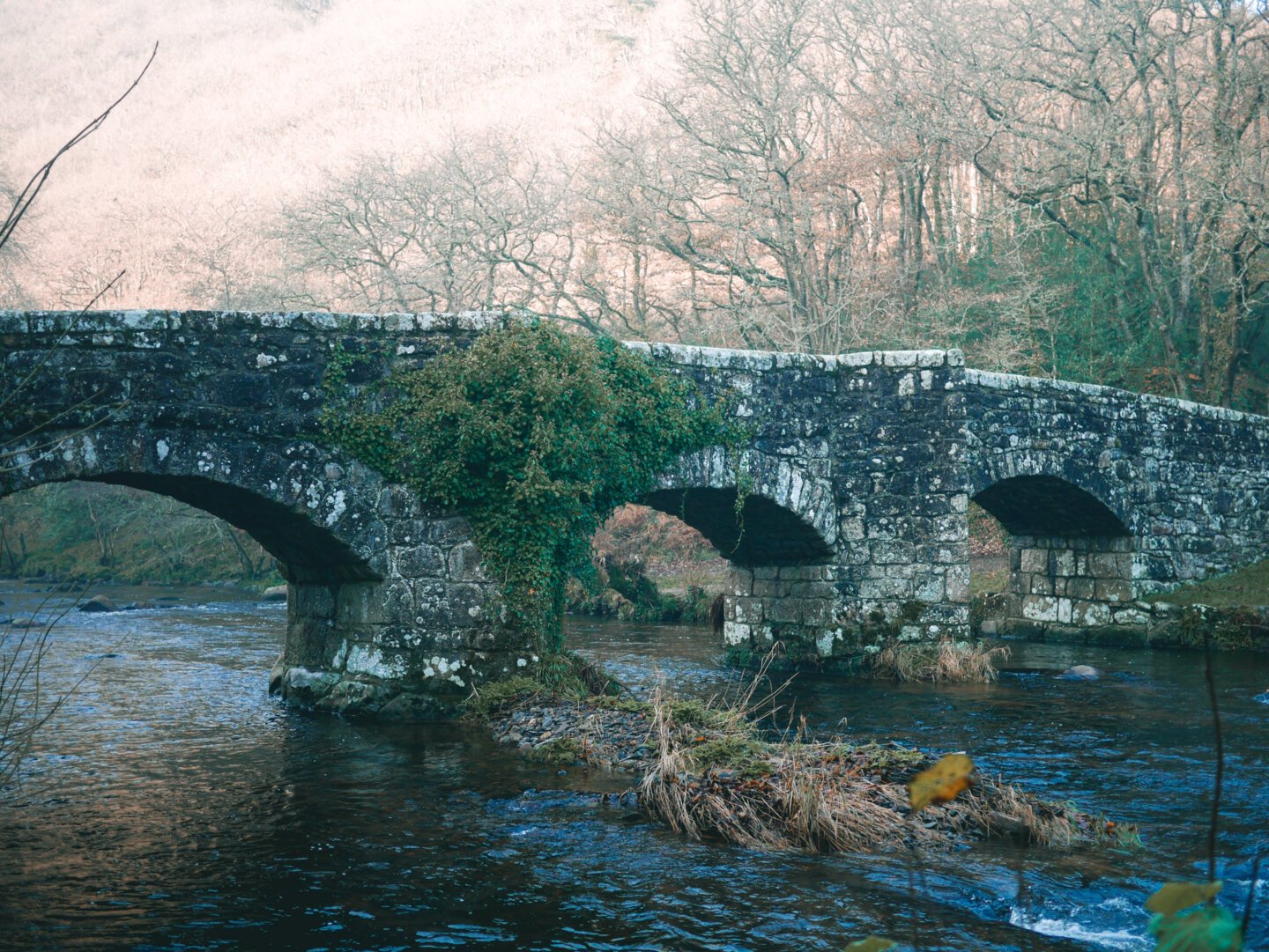
Step Five: Rest at Fingle Bridge
Fingle Bridge is a tourist hotspot no matter what time of year you grace its presence. It's an absurdly lovely packhorse bridge with a grade II listing and an air of superiority.
Much photographed and neighbouring a pub with a ludicrously good location, Fingle Bridge is the perfect place to rest and eat something. You'll need it, because the next stage is brutal. I warned you.
Step Six: Walk, push, curse me
I'd plotted this route without much consideration for my future self. The next section involves taking the earthen and rocky byway directly south of the bridge. If you can pedal this, you deserve a prize. For the rest of us mere mortals, it's a long and difficult walk, pushing the bike up uneven terrain. At least it's peaceful and pretty.
If you're not interested in spending 20-odd minutes pushing your bike up such an ascent, you can extend the ride by continuing along the Teign and taking the road from Clifford Bridge WSW to Cranbrook and where this path spits you out, sweaty and exhausted. It's longer, but pushing a bike is such a slow affair, it probably works out the same.
Step Seven: Pedal all the way back with a grin on your face
There's the odd hill on the way back, notably the road section on the Wray Valley Trail, but broadly, the entire way back is one absolutely epic descent. You'll start with a hair-raisingly steep descent down to Howton Farm and then enjoy the Wray Valley Trail again at a considerable speedier pace than the northward journey.
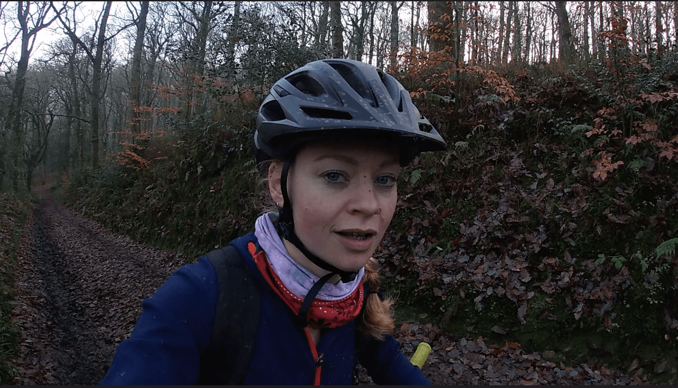
Want a route preview? Check out my video below, including the joyous pushing my bike up a hill section.
Want to watch more of my slightly experimental videos? Check them out here.