Riding the Dartmoor Way Cycle Route in Two Days (Plus Video!)
Cycling the Dartmoor Way has been high on my to-do list for yonks. The route is perhaps more commonly known as a hiking trail covering 95-miles and encircling this upland national park. The cycling route is a more recent creation, following a similar route and taking in some of Dartmoor's most fantastic landscapes and hidden villages. With two days of sunny bank holiday, I didn't have time to walk it.
In truth, I planned to cycle the route the moment Johnson announced overnight stays would be allowed again. I already live in one of the towns the Dartmoor Way passes through but doing the entire route in one day would be beyond my thighs: 2,100 metres (7,000 feet) of elevation gain across 90 miles. So I split the route into two with an overnight stop about 70% of the way around.
And this is how it went and how you can do it too.
Cycling the Dartmoor Way
Here's a route map for the entire loop, planned on komoot:
This route begins in Bovey Tracey (where I began) but you can start from anywhere along it; that's the joy of a loop. If you're not local, starting from Ivybridge in the south is a good shout as it's the only place on the route with a train station and a mainline one at that. If you do begin in Ivybridge and cycle clockwise, you'll be faced with a massive hill.
Hey, it's Dartmoor, no matter where you start you'll be faced with a massive hill.
I'd originally planned to ride anti-clockwise for no other reason except that it felt right. When I came to book accommodation though (first bank holiday after lockdown in a massive tourist destination...) there was nothing halfway, only one (affordable) place after 30 miles. I strongly didn't want to do a short first day and a killer second and felt a bit stuck. Until my clearer-headed sister said, 'why don't you just ride it the other way around?'
It's funny how our brains get stuck in ruts.
So, that unfailing logic was how I came to book the Fox & Hounds pub in Lydford, 57 miles from the start and 30 miles from the end. Not a bad split, all things considered. As you will undoubtedly undertake better planning than I, there are plenty of places in the west of Dartmoor to choose from for an overnight stop, Tavistock being a good halfway stop from Bovey. If you start in Ivybridge, Okehampton or Chagford might be good choices.
Cycling from Bovey to Ivybridge
Within about two metres of leaving Bovey high street, we immediately started climbing and this is pretty much all we did for the next six miles. Like most of the route, it spends its time meandering around quiet, narrow lanes oft-punctuated by thatched cottages and birdsong.
It's slow going but pretty and the descent into Ashburton was welcome. The next few miles were surprisingly enjoyable despite being on the old A38, a wide, fast link to Buckfastleigh. I was expecting it to be busy but actually it was quiet and gave us the opportunity to get some fluent speed up.
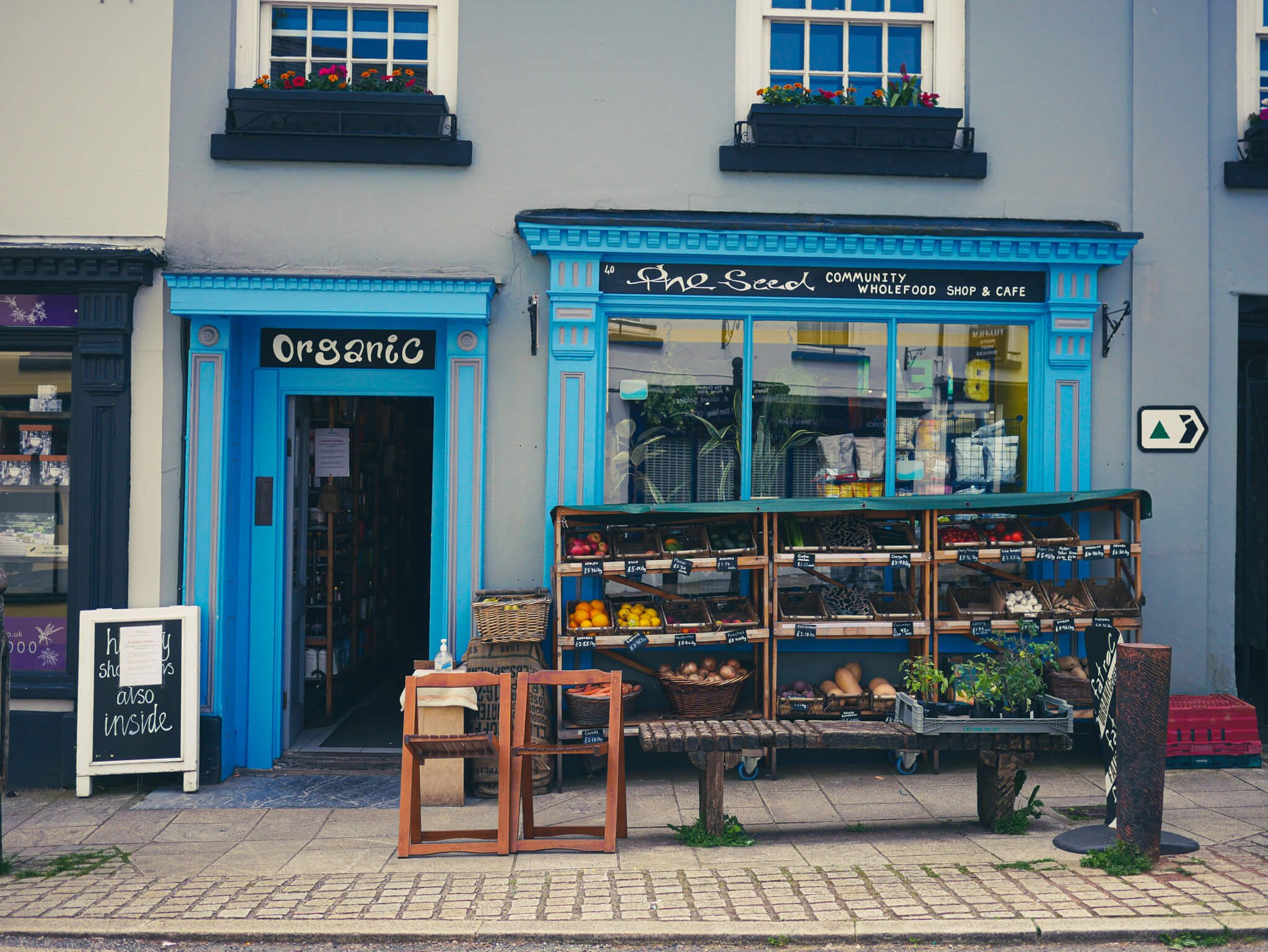
Sensing an opportunity for a coffee and a cake, we cycled into Buckfastleigh itself (although the route doesn't technically enter the town centre). Not willing to pedal too far out of our way, we stopped at the first place that had a coffee sign. It turned out to be The Seed, a Community Interest Company, and had excellent coffee and cake: a maca and cacao granola bar for us (when I read that back in proofreading I realise I sound like a wanker. It was really delicious though.)
From Buckfastleigh, we climbed a punishingly long hill but buoyed by fantastic hedgerows packed with flowers. The route undulates up here and we were rarely doing anything other than grinding up or freewheeling down. A gloriously fast and winding descent took us to Shipley Bridge, a pretty stone bridge south of the Avon Dam. Picturesque and on a good hiking route, the lanes and car park were rammed with cars, half of which seemed to be reversing out of each other's way.
Lunch stop
The lane from Shipley Bridge to South Brent is glorious, all vibrant trees and the rushing River Avon. The route sticks to the western edge of the village but we cycled over Lydia Bridge (which has a splendid waterfall tumbling next to it) and into South Brent for a spot of lunch. It has a Co-op, public toilets and a good few lunch benches.
So far, the ride was feeling an awful lot like a rollercoaster. It was hard to appreciate the scenery because we were either riding up incredibly steep hills at snail's pace or haring down them with the brakes jammed on trying to avoid the myriad, treacherous potholes. We vowed to stop often to eat and drink, particularly given the cloudless sky and 19 degree heat in direct sun.
When we got to Bittaford, we joined the main road into Ivybridge. This was another welcome break from the considerable ups and downs of the moor's perimeter. The route doesn't go into the town centre and instead skirts over the north. Ivybridge has plenty of food shops if you need to stock up though.
Ivybridge to Lydford
The Dartmoor Way is very much a 'what goes down must come up' kind of route. I suppose it makes sense given that it's a 300 million-year-old area of granite upland with over 160 tors, all of which demand their own summits to reign over. In case I'd forgotten this, the route lead from relatively low-lying Ivybridge up a massive, lengthy hill.
I mean, an epically long hill. Technically it starts from Cornwood but it was so all-encompassing that it certainly felt like it start in Ivybridge. It's not necessarily ultra-steep, especially compared to many of the hills on the route, but it is sustained. Luckily, it has a great view at the top over Plymouth Sound and a lay by from which to enjoy it.

We cycled past the enormous quarry workings around Lee Moor and headed up across the moor to Cadover Bridge. I love this section because it's proper open moor and reminds me of the New Forest, where I grew up, from an animal perspective. Here, Dartmoor ponies roam freely, cluttering up the roads and grazing without a care in the world. Sheep are even more common, munching in ditches or snoozing in woollen balls on the roadside. Lambs wait until you're almost alongside before deciding that, actually, they like the look of the other side of the road.
This isn't human territory, it belongs to the moor's grazers.
Western Dartmoor
The stretch from Cadover Bridge to Yelverton is one of my favourites of the whole route for the cycling itself. The roads are wide with sweeping bends that allow you to keep up a good speed and flow around bends like liquid. The views are also extraordinary, with dramatic tors pricking the sky in the distance. The only downside is the volume of traffic which somewhat detracts from the experience.
Getting into Yelverton felt like we'd made real progress because, to me, it represents the west side of the moor. We had a snack stop on grass by the start of the cycle path and watched some fuzzy foals rolling about. This section is part of Drake's Trail, a cycle/walking route from Tavistock to Plymouth and is a wonderful change to the lanes.
The Grenofen Tunnel is on this section and is quite an experience. At 342 metres long, the former railway tunnel is now a scantily-lit cycle path that plunges you into near pitch-black for a considerable stretch. Luckily, the literal light at the end of the tunnel guides you forward and there aren't any bends. Still, the tunnel is always wet and it felt like we were in an idle rain shower as we whizzed through.
The Tavys
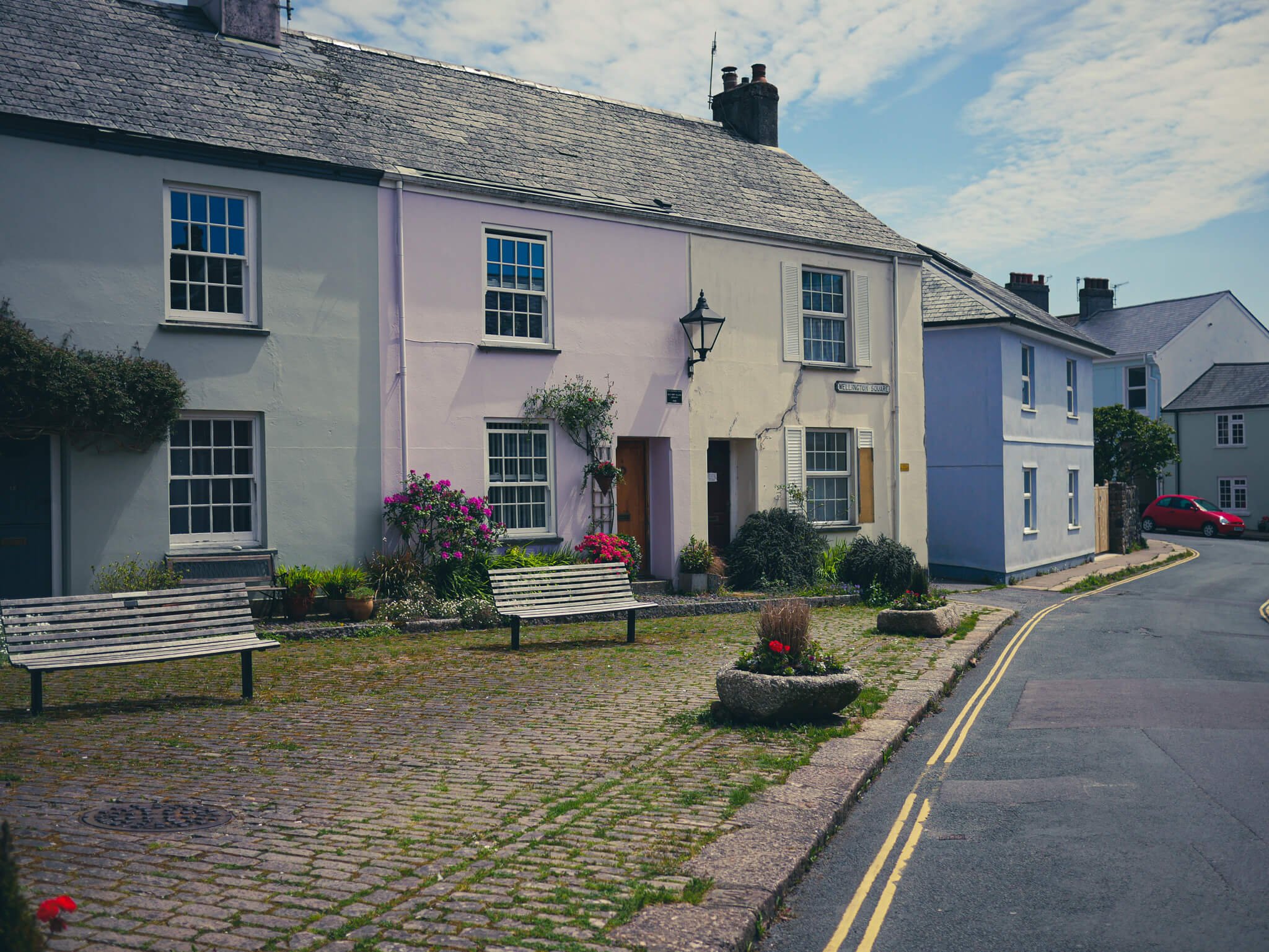
We cycled through Tavistock and I would've like to have stopped and explore a bit. The town is very pretty and I'm sure it'd make an excellent food stop. Alas, we were pushed for time and energy and carried right on through, barely making it up the hill to the north.
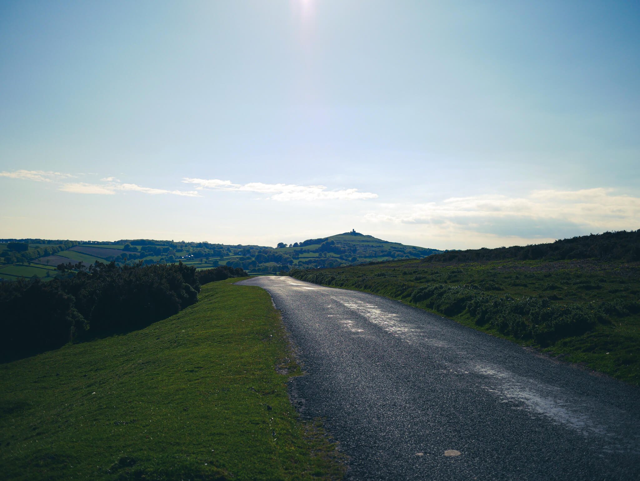
Next comes Peter and Mary Tavy, two villages on the border of the national park. At Peter Tavy, the Dartmoor Way uses a bridle path just past the pub which is a rather rocky affair in places. After Mary Tavy, we cycled over open moorland on the southern end of Gibbet Hill. This lane is particularly spectacular as the views to the lone church on Brent Tor are excellent. And a little haunting.
Now, the actual route goes into North Brentor and along the road to Lydford but I got it wrong and ended up going cross country following what turned out to be a footpath across open moor with added bogs. This wasn't ideal at the end of an extremely long day but whatever.
We eventually got to Lydford Gorge which has a brutal ascent up into Lydford. I don't know how I managed to cycle up it. The hotel being only two miles away at this point and our table being booked for 20 minutes time probably had a lot to do with it.
Lydford to Okehampton
The next day, we got onto the Granite Way, a marvellous, mostly flat cycle path that stretches between Okehampton and Lydford. This is fast and flowing with a mixture of tarmac and off-road sections. With two viaducts and a few picturesque bridges, it makes for a particularly easy and enjoyable section.
We followed the Dartmoor Way from Okehampton station down into the town and back up to the east. This was essentially three sides of a square involving a massive hill and lots of annoyed traffic. Unless you particularly want to go into Okehampton for something like food, I would avoid this. Instead, I would take the bridlepath from the station and follow it east alongside the tracks to rejoin the Dartmoor Way after crossing the river. Purists be damned.
Okehampton to Bovey
This final section is almost entirely on deserted lanes with high hedges, steep hills and hair-raising descents. It was an absolute joy in the sunshine and Chagford makes for a brilliant place to pause for coffee and cake (and public toilets).
The descents were sometimes brutal and because they're so twisty and the odd car cropped up, it was pretty important to be handy on the brakes. I skidded my back wheel once stopping for a surprise voiture.
Once in Chagford, we scouted around for sustenance and had a fantastic flat white from the Green Man Cafe, a vegetarian and vegan place with a hefty choice of cakes.
The hills between Chagford and Moretonhampstead felt a lot steeper than perhaps they would've done at the beginning of the journey but that's psychology for you. From Moretonhampstead, we took the Wray Valley Trail all the way back to Bovey with a look of pure joy on our faces because it's ever so slightly downhill and mostly traffic-free.
After, I realised that the Dartmoor Way actually goes uphill to the Kennick Reservoir before descending back into Bovey but, you know what? I don't think my legs could've coped with it anyway. So there you go.


Retrospective Thoughts on Cycling the Dartmoor Way
The Dartmoor Way is a singularly brilliant way of exploring the national park's lanes. There are multitudes of them. Each unfurling like ribbons over the hills and alongside fields. We absolutely lucked out on the weather with this trip. A cool easterly perfectly complemented the harsh sunshine and provided an ideal balance for cycling.
The split of the route was a challenge as it made the first day a very long one. If we'd had more choice for accommodation, perhaps closer to Tavistock would've been better. You can actually wild camp on the moor around there. We weren't sufficiently organised for it and, when we booked the hotel, had no idea what the weather was going to be like. Given that it had rained for three solid weeks prior, the risk of a torrential night wild camping was too high.
This is an incredibly hilly route: you are very much either going steeply up or steeply down. There's no getting around its rollercoaster nature, so if you're considering doing the Dartmoor Way, make sure you're well prepared for hills, particularly if you normally ride in a flatter area. Doing the ride over three days is very possible with the amount of towns to overnight in.
Would I do it again?
Yup.